


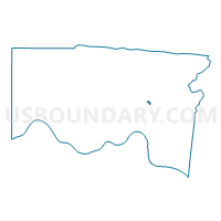
Voting District CINCINNATI 14-I, Hamilton County, Ohio
About
Outline

Summary
| Unique Area Identifier | 647130 |
| Name | Voting District CINCINNATI 14-I |
| County | Hamilton County |
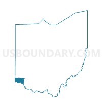
| State | Ohio |
| Area (square miles) | 0.10 |
| Land Area (square miles) | 0.10 |
| Water Area (square miles) | 0.00 |
| % of Land Area | 100.00 |
| % of Water Area | 0.00 |
| Latitude of the Internal Point | 39.18580350 |
| Longtitude of the Internal Point | -84.43079610 |
Maps

Graphs
Select a template below for downloading or customizing gragh for Voting District CINCINNATI 14-I, Hamilton County, Ohio


Neighbors
Neighoring Voting District (by Name) Neighboring Voting District on the Map
- Voting District AMBERLEY B, Hamilton County, OH
- Voting District CINCINNATI 14-A, Hamilton County, OH
- Voting District CINCINNATI 14-C, Hamilton County, OH
- Voting District CINCINNATI 14-H, Hamilton County, OH
- Voting District CINCINNATI 14-K, Hamilton County, OH
- Voting District COLUMBIA C, Hamilton County, OH
Top 10 Neighboring County Subdivision (by Population) Neighboring County Subdivision on the Map
- Cincinnati city, Hamilton County, OH (296,943)
- Columbia township, Hamilton County, OH (4,532)
- Amberley village, Hamilton County, OH (3,585)